PRESS RELEASE:
Chennai | 19.04.2025


A Decade After the 2015 Chennai Floods, Pallikaranai Still Floods
Study Calls for Data-Driven, Catchment-Based Action
கெடுப்பதூஉம் கெட்டார்க்குச் சார்வாய்மற் றாங்கே
எடுப்பதூஉம் எல்லாம் மழை
15 | வான் சிறப்பு | திருக்குறள்
பெய்யாமல் வாழ்வைக் கெடுக்க வல்லதும் மழை; மழையில்லாமல் வளம் கெட்டு நொந்தவர்க்குத் துணையாய் அவ்வாறே காக்க வல்லதும் மழையாகும்.
Ten years after the devastating 2015 floods in Chennai, the Pallikaranai region continues to flood during every monsoon. Despite numerous government interventions, the frequency and intensity of flooding have not reduced. In fact, the fear among residents has only deepened — people still park their vehicles on bridges during rains, a stark reminder of eroded public trust in flood mitigation systems.
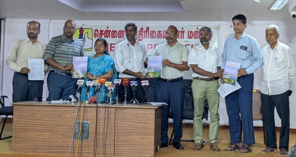
A study by Uvakai Research Foundation Titled “Hydrological Insights from Pallikaranai Catchment in Kovalam Basin”, takes a catchment-based approach to identify long-term, sustainable solutions to protect lives and livelihoods in this region.
The Chennai River Basin, spanning 4,959.1 sq. km in North Tamil Nadu, drains into the Bay of Bengal through four major rivers—Araniar, Korattalaiyar (Kosasthalaiyar), Cooum, and Adyar. A unique component of this system is the Kovalam sub-basin, which, unlike the others, doesn’t form a river but drains through low-lying areas forming marshes and backwaters. Covering about 812 sq. km, the Kovalam Basin ultimately discharges into the sea near Muttukadu and Ediyur through estuarine systems.
The Kovalam Basin is divided into five catchments. Among these, the northern three catchments fall within the Greater Chennai Corporation, Tambaram City Municipal Corporation—both within the Chennai Metropolitan Area—and also include a few villages from Chengalpattu District. These catchments drain into the Pallikaranai Marsh and are carried onward through Okkiyamaduvu and the Buckingham Canal, eventually reaching the sea near Muttukadu. The two southern catchments discharge into the Great Saltwater Lake and eventually reach the sea near Ediyur.
The Pallikaranai Catchment, spanning 306.27 sq. km, comprises three sub-catchments—two that drain into the Pallikaranai Marsh and one that drains directly into the Buckingham Canal. It is a vital hydrological zone, known for its dense network of interconnected waterbodies. These waterbodies span 77 villages, from Guindy Park in the north to Muttukadu in the southeast, Vandalur in the southwest, and St. Thomas Mount in the west.
The Pallikaranai Marsh, covering 694 hectares, is one of Chennai’s last remaining natural wetlands. It plays a vital role in flood mitigation, groundwater recharge, and biodiversity conservation. Declared a Reserve Forest under the Tamil Nadu Forest Act (1882) and recognized as a Ramsar Wetland of International Importance in April 2022 (Site No. 2481), it remains a critical ecological buffer amid rapid urbanization.
Key Findings:
- 452 water bodies were identified in the Pallikaranai catchment using multiple sources, including revenue maps, satellite imagery (ISRO-Bhuvan), RTI records, and Google Earth.
- These include 119 lakes, 249 tanks, 39 temple tanks, 45 abandoned quarries, and 1 stagnated waterbody.
- Comparing historical maps with present-day data, 165 water bodies (31 lakes and 134 tanks) have completely disappeared due to encroachments. This accounts for 7.35 sq. km of lost waterbody area.
Floods and Water Shortage – Two Sides of the Same Problem
The catchment contains 25 sq. km of waterbodies, with a combined storage capacity of 37.5 million cubic meters (mcm), based on the 2019–2020 land use map and assuming an average depth of 1.5 meters. This is equivalent to approximately 1.32 tmc (thousand million cubic feet).
- The Pallikaranai Marsh alone, spanning 694 hectares, can store approximately 6.94 million cubic meters (mcm) of water—equivalent to about 0.245 tmc (thousand million cubic feet)—assuming an average depth of 1 meter.
- In the Pallikaranai catchment, a 100 mm rainfall event generates approximately 17.61 million cubic meters (mcm) of runoff, equivalent to about 0.622 tmc (thousand million cubic feet). The total storage capacity of the catchment’s waterbodies and the Pallikaranai Marsh is around 44.5 mcm (approximately 1.572 tmc). This means that after accommodating the runoff, about 26.89 mcm (0.95 tmc)—or nearly 60% of the total storage capacity—would still remain available.
- In an extreme rainfall scenario of 400 mm, the Pallikaranai catchment generates approximately 70.44 million cubic meters (mcm) of runoff, which is about 2.487 tmc. The total storage capacity in the catchment—including waterbodies and the Pallikaranai Marsh—is 44.5 mcm (1.572 tmc). This means the system can retain about 63% of the runoff, while the remaining 25.94 mcm (0.915 tmc), or 37%, would overflow and drain out, unless additional storage measures are taken.
- The remaining 37% can flow safely to the sea through natural drains like Okkiyamaduvu and B Canal, provided they are well-maintained and function efficiently.
- However, instead of allowing this 37% to drain away, it can be stored. With proper planning—such as deepening existing waterbodies, restoring original depths through desilting, and identifying additional storage spaces—this excess water can be saved and used to meet the city’s water needs.
- Historical rainfall data (1901-2021) shows average peak season rainfall at 340–360 mm per month, and even in extreme cases like Cyclone Michaung (2023), when 500 mm fell in just 36 hours, the system has the potential to absorb and store large volumes. This presents an opportunity—not a threat—if managed wisely.
A Missed Opportunity: Water Lost to the Sea
- While conservative estimates based on the 2011 Census place South Chennai’s population at around 27 lakh, the CMWSSB projects a significantly higher growth—estimating the population to reach 45 to 50 lakh by 2025. Accordingly, the daily water demand is projected to be between 600 and 675 million liters (MLD). Current government supply includes:
- Nemmeli Desalination Plants (Phase 1 & 2): 250 MLD (42%)
- Veeranam Lake & Reservoir: 180–200 MLD (30%)
- Groundwater & Borewells: 30–50 MLD (5-7%)
- Poondi & Puzhal Reservoirs: 30–40 MLD (5%)
- This totals 500 to 520 MLD, falling short by 80 to 150 MLD, creating a significant supply-demand gap.
- The daily water requirement of South Chennai is approximately 600 million liters per day, which is equivalent to about 0.0212 tmc (thousand million cubic feet).
- The current storage capacity within the Pallikaranai catchment—including its lakes and marshland—is 44.5 million cubic meters, which equals approximately 1.572 tmc. This volume is sufficient to meet South Chennai’s water needs for about 74 days.
- Additionally, the remaining 26 million cubic meters of runoff—about 0.918 tmc or 37% of the total runoff—could meet the city’s needs for another 43 days if it is harvested instead of being lost to the sea.
- Considering the two monsoon seasons (Southwest and Northeast), if waterbodies are managed effectively to allow for multiple fillings, the same storage infrastructure can potentially hold and supply even more water across the year.
- To make better use of this resource, we should explore ways to enhance the capacity of existing waterbodies—such as desilting or restoring their original depth—so that more rainwater can be stored and used effectively, rather than being lost.
Sewage Management:
- As per the 2011 Census, the population across 77 villages within the Pallikaranai catchment was 26.13 lakh. Using the Government of Tamil Nadu’s official annual growth rate of 0.30%, the estimated population in 2025 is approximately 27.26 lakh. Assuming a standard per capita sewage generation of 100–135 liters/day, and that 80% of water supplied is returned as sewage, the total sewage generated in the catchment amounts to approximately 294.44 million liters per day (MLD) or 0.2944 million cubic meters per day (MCM/day).
Based on the CMWSSB’s projections, South Chennai’s population is expected to reach 45 to 50 lakh by 2025. Using this estimate, the daily sewage generation would be approximately 0.017 to 0.019 TMC. This would suggest that, under these population projections, the Pallikaranai catchment (with a storage capacity of 1.57 TMC) could potentially be filled in about 83 to 92 days by the generated sewage alone.
However, it is important to note that there are different population projections—one based on the 2011 census, which estimates the population at around 27 lakh. The variation in these estimates highlights the need for cautious planning and consideration of future demand when assessing the region’s water and sewage management strategies.
- Yet untreated sewage threatens groundwater quality and infiltration.
- The study advocates for decentralized STPs over large centralized systems, which are costlier and harder to maintain. Properly maintained, these systems can ensure cleaner water and enhanced reuse.
Drainage Infrastructure Needs Overhaul
The current drainage system is both inadequate and poorly maintained. Restoration of Okkiyam Maduvu by widening it to 100 meters and dredging it to a depth of 1.5 meters, along with cleaning silt and removing blockages, could significantly reduce flood risk.
If these improvements are made:
• 100 mm of floodwater can be drained within a day.
• 400 mm of floodwater can be discharged within five days, even during intense storms.
Recommendations:
Strengthen Watershed-Level Data Systems
Effective planning begins with reliable data. This requires investment in high-resolution elevation maps, bathymetric surveys of waterbodies, meso-scale rain gauge stations to capture localized rainfall, soil studies, and real-time monitoring systems. These tools are essential for making informed, science-based decisions rather than relying on assumptions.
Use Data for Smarter Planning
Instead of reacting to disasters after they happen, we should shift to proactive planning. Government departments must work together and continuously update data—both at large and local scales—to guide development.
Focus on Nature-Based and Long-Term Solutions
Disaster relief funds should not be limited to short-term fixes. Instead, they must be directed toward long-lasting, nature-based solutions—such as restoring natural drainage channels, wetlands, and waterbodies—rather than investing in expensive concrete infrastructure that disrupts ecosystems.
For instance, the proposed ₹91 crore “cut and cover” canal to drain Pallikaranai water via Okkiyamaduvu should be reconsidered. A more sustainable and cost-effective alternative would be to widen and deepen the existing Buckingham Canal to improve natural drainage.
Require Proper Scientific Assessments
Before approving major projects in ecologically sensitive areas, comprehensive environmental and hydrological assessments must be carried out—not just within the immediate project site, but across the entire catchment or river basin. This holistic approach is essential to fully understand and mitigate long-term impacts.
Protect Low-Lying Areas from Development
The Pallikaranai Marshland sits at a low elevation, ranging from +2 meters to -2 meters above mean sea level. Nearly 28% of the Pallikaranai Catchment—about 86 sq. km—falls within these low-lying and flood-prone zones. Given their ecological significance and vulnerability, these areas must be designated as no-development zones and permanently safeguarded as ecologically sensitive regions. Large-scale developments, such as the proposed Global Sports City, should be relocated to safer, more appropriate locations that are less prone to environmental risk.
Restore Traditional Water Systems
The regional landscape and local wisdom must be given the importance they deserve. India is already home to natural sponge landscapes—such as lakes, wetlands, and drainage channels—that were historically designed to manage water effectively. There is no need to build new systems from scratch. Instead, the focus should be on identifying, protecting, and restoring these time-tested natural systems to strengthen flood resilience and water security.
Use Local Expertise for Better Results
Technical institutions such as IIT Madras, Anna University, and others should be brought in not just for one-time project-based studies, but as long-term custodians for waterbodies and catchments. Their role must extend beyond technical assessments to include continuous support in planning, monitoring, and execution. Assigning institutional responsibility will ensure scientific rigor, accountability, and sustainability in water management efforts.
Set Up a Community-Led Water and Ecology Watch
People living in these areas should be involved in monitoring changes in lakes, drainage systems, and sensitive areas. A community-led observatory will encourage local participation and ensure better care of natural resources.
Conclusion
The solution lies not in building more infrastructure, but in restoring and strengthening what already exists. Diverting precious rainwater directly to the sea and investing heavily in engineering solutions to recover it later is neither sustainable nor economical. While proposals are underway to expand such facilities, this report strongly advocates for a more prudent approach: conserving and utilizing the rainwater that naturally falls within the Pallikaranai catchment.
The once-thriving hydrological systems of Pallikaranai urgently need revival and protection. This study calls for a shift from reactive flood management to a proactive, data-driven, and ecologically sensitive strategy—one that ensures long-term water security and flood resilience for Chennai.
For more information, interviews, or access to the full study, please contact:
Dr. E. Vidhubala I Arch. N. Udhayarajan,
Uvakai Research Foundation
info@uvakai.org | 94442 74700 I 94441 40528
